To carry out its mission in the scope of MCE - Monitorização e Controlo do Espectro (Spectrum Monitoring and Control), ANACOM has a set of technical and monitoring infrastructure (fixed and mobile).
Fixed MCE infrastructure is made up of:
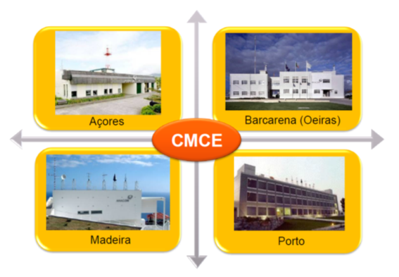
- Four staffedhttps://anacom.pt/streaming/CMCE.PNG?contentId=1409705&field=IMAGE centres in the national territory.
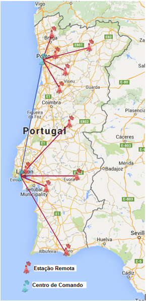
- SINCRERhttps://anacom.pt/streaming/SINCRER.PNG?contentId=1409707&field=IMAGE - Sistema Nacional de Controlo Remoto das Emissões Radioelétrica (National System for Remote Control of Radioelectric Emissions), composed of ten remote stations distributed throughout the territory of mainland Portugal.
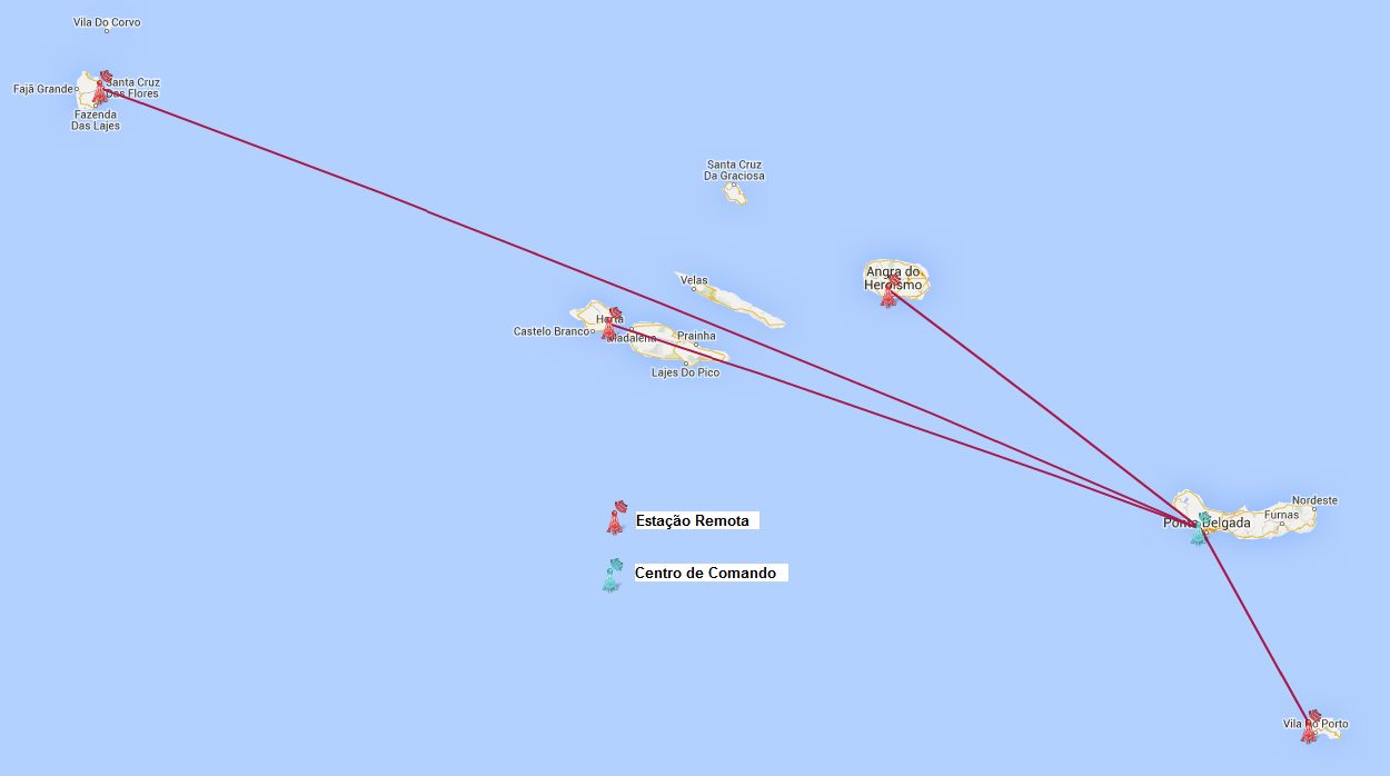
- The remote stations of the Madeirahttp://anacom.pt/streaming/MCE_Madeira.png?contentId=1409708&field=IMAGE and Azoreshttp://anacom.pt/streaming/MCE_Acores.png?contentId=1409709&field=IMAGE archipelagos.
To ensure the proper functioning of monitoring centres and remote stations, there can be no other radiocommunication stations operating in their vicinity whose emissions could degrade reception conditions. As such, and without prejudice to the conditions established in the applicable regulations, and with the exception of stations already coordinated with ANACOM, the use of fixed, mobile or portable radiocommunication stations is prohibited within a radius of 500 meters of any centre or remote monitoring station. See geographical areas of restriction1.
The use of stations in geographical areas of restriction may be authorised on an exceptional basis. Requests for authorisation should be sent by email to CMCE - Centro de Monitorização e Controlo do Espectrohttps://www.anacom.pt/render.jsp?categoryId=391349 (Spectrum Monitoring and Control Centre) at least 5 days in advance, with the following items:
(a) location of use (kml/kmz file);
b) purpose of use;
c) date/time of commencement of use;
d) date/time of end of use;
e) frequencies that will be used;
f) maximum apparent radiated powers used at each frequency;
g) person responsible for the use;
h) contact details (telephone and email) of the person responsible for use.
Such use may be commenced only subsequent to receiving express authorization from ANACOM.
In addition, there is a network of probes used for monitoring and control of digital terrestrial televisionhttps://www.anacom.pt/render.jsp?categoryId=384835.
Mobile infrastructure includes:
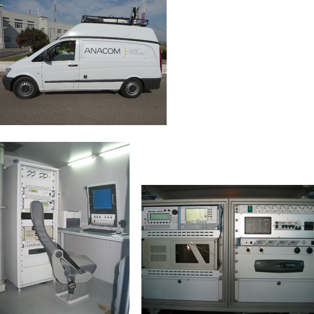
- dedicated motor vehicleshttps://anacom.pt/streaming/VeiculosAutomoveis_dedicados.PNG?contentId=1409710&field=IMAGE in Mainland Portugal, Madeira and the Azores, specially adapted for the MCE function, which can operate singularly or integrated with fixed remote stations.
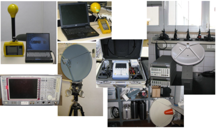
- portable equipment-https://anacom.pt/streaming/equipamentos_portateis.PNG?contentId=1409711&field=IMAGE this set of infrastructure, transported in non-dedicated vehicles, comprises all the complementary equipment that MCE uses in the field.
1 1 File in kmz format; to open - use Google Earth in Chrome (browser) and import the file previously saved on the desktop. Further information: https://support.google.com/earth/answer/7365595?hl=en&ref_topic=7364446https://support.google.com/earth/answer/7365595?hl=en&ref_topic=7364446.
")


